

Kathmandu: Nepal’s devastating floods have exposed a major challenge in disaster preparedness — some of the hazards threatening communities downstream begin beyond the country’s borders.
The Bhote Kosi, Trishuli, Karnali and Arun river systems are closely linked to the Tibetan Plateau in China. Changes in glaciers, glacial lakes, landslides and river flows upstream can quickly turn into destructive floods in Nepal.
The danger can begin beyond Nepal
Two Bhote Kosi rivers originate in Tibet before entering Nepal through Kodari and Rasuwa. Their steep courses pass settlements, hydropower projects, roads and key trade routes connecting Nepal and China.
The problem is that Nepal does not consistently receive rainfall and flood-water information from the Chinese side.
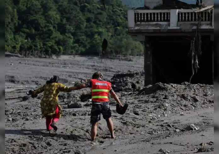
During the July 2025 Bhote Kosi flood, at least 18 people were killed and the Friendship Bridge at Rasuwagadhi was destroyed. Hydropower projects, transmission lines and roads were also damaged.
Nepal’s flood forecasting authorities reportedly became aware of the latest flood only after the water had reached Betrawati.
An alert is not always an early warning
Nepal has demonstrated that it can quickly alert communities once a flood enters the country. Mass SMS warnings have been used to inform people downstream.
But experts cited in the source argue that this is different from a genuine early-warning system.
The World Meteorological Organization describes effective early warning as a chain involving risk knowledge, monitoring and forecasting, communication and preparedness.
If an upstream glacial lake suddenly drains or a landslide blocks a river, communities downstream need information before the flood reaches them.
Scientists already know many of the risks
Research has identified numerous vulnerable glacial lakes in the transboundary basins.
A 2025 assessment identified 28 glacial lakes as highly susceptible to glacial lake outburst floods. Under extreme scenarios, such floods could threaten thousands of buildings, bridges, hydropower sites and roads.
The Hindu Kush Himalaya region is also experiencing accelerating glacier ice loss, adding to concerns about future risks.
Nepal needs information to cross borders
Nepal’s challenge is therefore not simply a lack of scientific information. Satellite imagery, glacier inventories and hydrological models already provide valuable data.
The bigger challenge is connecting this information with government agencies, rescue teams, hydropower operators and communities.
The August 13 landslide near Nyalam showed that upstream events can sometimes be detected and communicated. However, such coordination needs to become systematic rather than occasional.
Rebuilding must also reduce future risks
The floods have repeatedly damaged the Betrawati-Rasuwagadhi corridor, washing away roads and bridges.
Rebuilding the same infrastructure without incorporating new hazard information could leave communities exposed to the same risks again.
Nepal cannot prevent every landslide or predict every flood. But it can develop systems in which an upstream disturbance immediately triggers monitoring, information-sharing, risk assessment and preparedness downstream.
The recent floods have made one question increasingly urgent: Will Nepal know what is happening upstream early enough to save lives downstream?